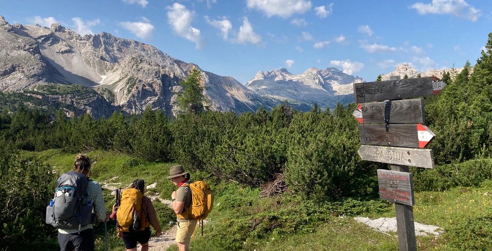
A day by day recap of my nine day hike on the Alta Via 1 in the Italian Alps.
Pre-Hike:
Our trip began in Venice. After a few days there we rented a car, drove to Conegliano, dropped off our luggage at the hotel we were to stay at after the hike. Then we drove north along the eastern side of the Dolomites to Lago di Braies.


We stayed two nights on the lake at Hotel Pragser Wildsee. The hotel was lovely, the food was superb, and the scenery was outstanding.
There are many tourists in the morning but it clears out by mid afternoon. I highly recommend staying here before beginning the trek.
Day 1:
Lago di Braies to Rifugio Sennes
6.6 miles, 4,304ft elevation gain


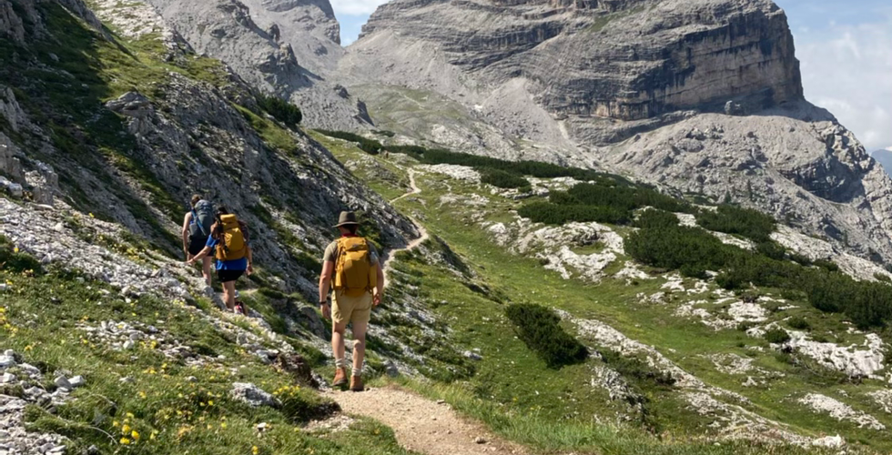
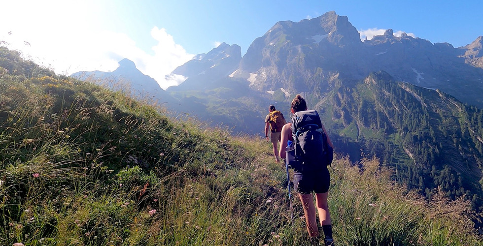
The Alta Via 1 trail starts half way around beautiful Lago di Braies. Then begins the long ascent into the Dolomites. The trail continues uphill until finally reaching Rifugio Biella.
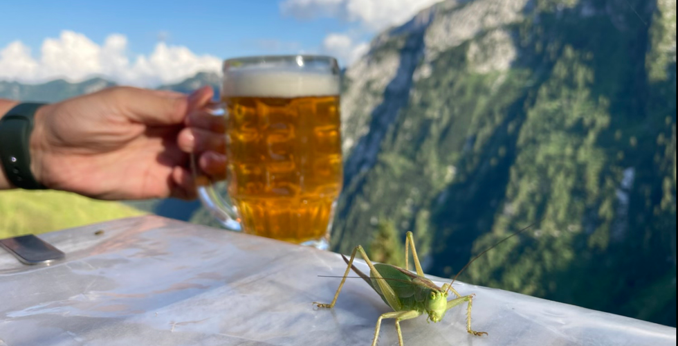
Then we continued through rolling grassy hills with tons of wildflowers. The usual afternoon summer storm started to close in just as we got a glimpse of Rifugio Sennes, our first destination on the trail. After a beer, a shower, and a delicious dinner; the skies cleared and we were able to enjoy the beautiful views surrounding the Rifugio.
Day 2:
Rifugio Sennes to Rifugio Fanes
6.9 miles, 2,762ft elevation gain


From Rifugio Sennes we set off mostly downhill towards Rifugio Pedaru. Pedaru is accessible by car so we encountered many day hikers and mountain bikers along today's route. After a coffee & juice break there, we continued uphill until we reached Rifugio Fanes. Fanes was among our favorite meals on the trail. Another day well spent in the beautiful Dolomites.
Day 3:
Rifugio Fanes to Rifugio Lagazuoi
9.5 miles, 3,800ft elevation gain
What a day! It started off easy going, passing through valleys filled with cows and then horses. Then we turned onto the trail bound for Lago Lagazuoi. We continued uphill toward Forcela di Lech; from there we could see down to Lago Lagazuoi and up the following mountain for a tiny glimpse of Rifugio Lagazuoi in the distance. The descent down to the lake is steep with many short switchbacks.


After a quick swim we began the daunting uphill climb. While not too steep, it seemed endless, with the Rifugio constantly in sight and never seeming to get closer! This uphill on Mount Lagazuoi is full of WW1 history. It was the frontlines between the Italian and Austro Hungarian forces. It is an open air museum; tunnels, officers huts, trenches and relics can be seen along the way. When we finally reached the Rifugio, we were able to enjoy a beer on the panoramic deck just before a storm rolled through. Luckily it cleared up by sunset so we could enjoy the incredible 360 views. And well worth the early wake up to watch sunrise here as well. Stunning.
Day 4:
Rifugio Lagazuoi to Rifugio Averau
via variant: WW1 tunnels
We opted to do the variant to explore the WW1 tunnels. We sent our packs down the gondola then descended the tunnels for the next hour or so. We started early and had the tunnels nearly to ourselves.


After the tunnels we collected our bags, had coffee & tea in Passeo Falzrego then continued up trail 441 toward Rifugio Averau. We started off in vibrant green hills, then some rock scrambling, then skirted around the back of of Mount Averau to arrive at Rifugio Averau.
We arrived early afternoon and it was quite busy with day visitors but quieted down by dinner. The food was excellent, our room was lovely and included a private balcony with views of Cinque Torri. The Rifugio even has a washer and dryer, which we took advantage of. And once again, spectacular sunset views.
Day 5:
Rifugio Averau to Rifugio Staulanza
12.4 miles, 2,287ft elevation gain
This was quite a day! It was one of our longest mileage days and we had to seek shelter twice because of hail, thunder & lightning!


Because of the weather we started off with the variant through Passo Giau, avoiding the via ferrata at Nuvolau. We briefly sheltered under a boulder while it was hailing. Shortly after it was blue skies again. We stopped at the next Rifugio for coffee & tea, and let our things dry in the sun before continuing on. We passed through so many different landscapes today, all stunning. As we were nearing Città di Fume we got caught in another hail storm, we sheltered under tree canopy. Again it was brief and then sunny blue skies. By the time we reached Rifugio Staulanza we were exhausted. Much to our delight we learned there was a spa! The sauna/steam/baths really turned our spirits around! After a delicious dinner we all slept like babies.
Day 6:
Rifugio Staulanza to Rifugio Tissi
7.9 miles, 3,107ft elevation gain


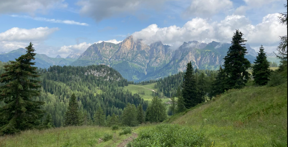


This was the first day we didn't have sweeping 360 views all day. We've been spoiled thus far! About half way though our day we reached Rifugio Coldai, just as storm clouds rolled in. Most hikers we met along the way stayed here, however we were continuing on. The storm itself didn't last long but the remainder of our day was hiking through the clouds; an experience in itself, but we probably missed out on some incredible views.
We stayed at Rifugio Tissi, the most sparse one on our itinerary. Heated by wood furnace, this Rifugio had a very homey feel to it and was the most communal.
Day 7:
Rifugio Tissi to Rifugio San Sebastiáno
11.5 miles, 2,694ft elevation gain


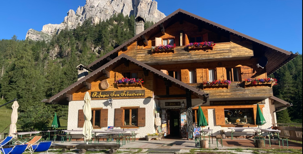


We were all a bit exhausted today! Today entailed various terrains: a lot of mud and scree, some rock scrambling, a little snow. It was a little longer with more uphill than we expected. We stopped at Rifugio Vazzoler in the morning and Rifugio Carestino in the afternoon, where we waited out the afternoon rain before making it to Rifugio San Sebastiano.
While it wasn't my favorite day on the trail, it was my favorite night. It was storming out, the wine was flowing and the Rifugio was cozy. It is run by the sweetest man with the help of his daughter; they were so kind.
Day 8:
Rifugio San Sebastiano to Rifugio Pian de Fontana
11.3 miles, 4,042 ft elevation gain


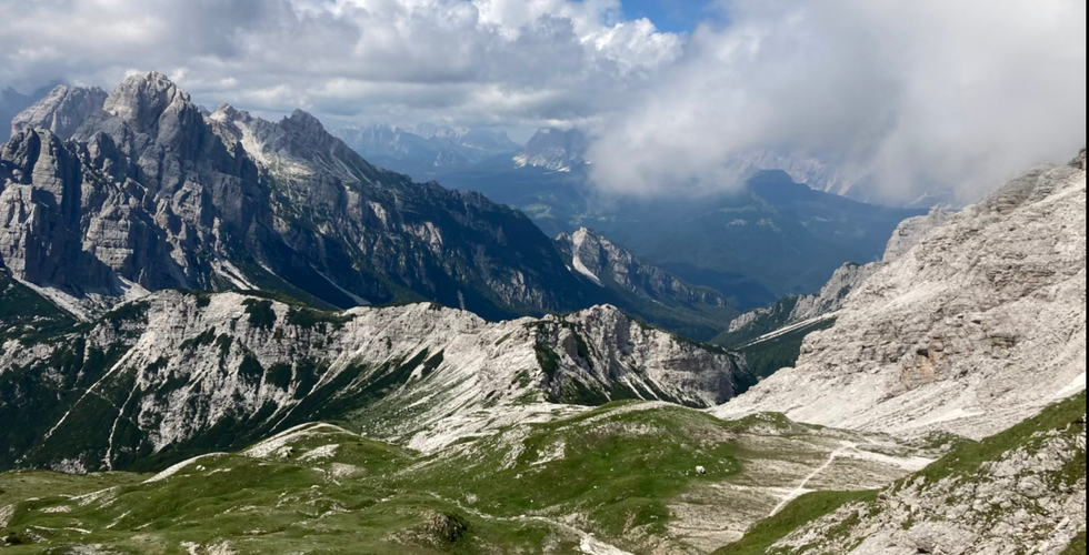


Possibly my favorite day of the whole AV1. At first it was back and forth stretches of forest and scree. We stopped for lunch at Rifugio Pamperet, then it was steep uphill. Then more uphill. Then WOW! Stunning 360 views. There was a small stretch of rock scramble up an exposed ridge, not nearly as scary as it first appeared. Then there was a mile or two of beautiful grassy descent through a valley. Then brutal, steep downhill to reach Rifugio Pian de Fontana.
Day 9:
Rifugio Pian de Fontana to FINISH!
7.7 miles, 942ft elevation gain


Our final day on the trail. A brief uphill to the last vista of the AV1: Forcella la Varetta. To my surprise some people found this path scary, a narrow grassy trail on a steep slope. Then it was all descent, through forest, switchbacks on a gravel road, more forest until reaching the road, and a quick walk to La Pissa bus stop. While waiting for the bus we reunited with many of the hikers we've seen these past 9 days. We all piled our gear into a heap on the bus.
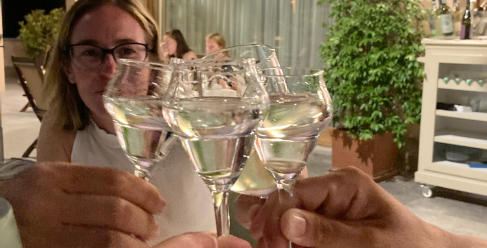
From Belluno we took the train 1 hour south to Conegliano. Here we spent 2 days relaxing at the beautiful Relais le Betulle, in the Prosecco hills. I couldn't think of a better way to end the trek! And it was nice swapping stories from the trail with the German couple who also happened to be staying at the same hotel!
This was the trip of a lifetime! It should be on everyones bucket list.
If you are considering hiking the AV1 check out my Planning post for some helpful information.
Bình luận